May 2020
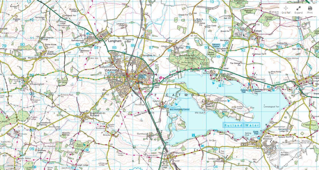
From the image or from a printed version of the attached PDF please find the 6 digit map references for the following :
- Train Station
- Railway Tunnel ( map reference for both ends)
- Telephone
- Car Parking (x3)
- Road with a Gradient
- Nature Reserve
- Falconry Centre
- Moat
- Sailing Club
- A County Boundary where it crosses the River Chater
- A National Cycle Network route number
- Find three other interesting locations you might want to share
Remember we need the 6 digit map reference for each – X axis first then Y so the disused Airfield in the bottom right hand corner would be 941 047 for the A
Please email me your answers / upload them to badges at home and be prepared to share your 3 interesting finds.
The following pdf is a explanation of the OS symbols top help you/
This map comes from the Ordnance Survey website https://osmaps.ordnancesurvey.co.uk/ . If you like maps then the 7 day trial is worth taking out and you can explore the country by map at least.
There are other activities to take part in here https://getoutside.ordnancesurvey.co.uk/adventures/